Note: This is a story I wrote that was published in the Lubbock Avalanche-Journal Caprock Chronicles, April 28, 2018.
Link to the online story:
Imagine being able to see the Llano Estacado as it once was before farming and development started. Even imagine being in a wagon crossing the vast Llano grassland and seeing a pair of Golden eagles dancing overhead. Now, keep those thoughts in your mind.
In 1935 this region was still in the midst of the Dust Bowl. Farmers were doing what they could to grow their crops and feed their families. However, migratory birds did not know what a Dust Bowl was. They were doing what they did naturally: migrate from the north to reside here for the winter and dine on farmers’ crops.
Naturally, these birds were distressing the farmers because they were eating up their profits and some farmers started shooting the birds. In the early 1930s, lesser sandhill cranes and other migratory birds were using the high plains in increasing numbers. They roosted on the saline or playa lakes at night and flew to surrounding agricultural fields at during the day to feed. There were numerous cases of shooting birds out of season in this region of Texas.
The federal government began noticing regional farmers’ plight during the Dust Bowl, plus they knew the farmers had to abide by the Migratory Bird Treaty Act of 1918 enacted to protect migratory birds.
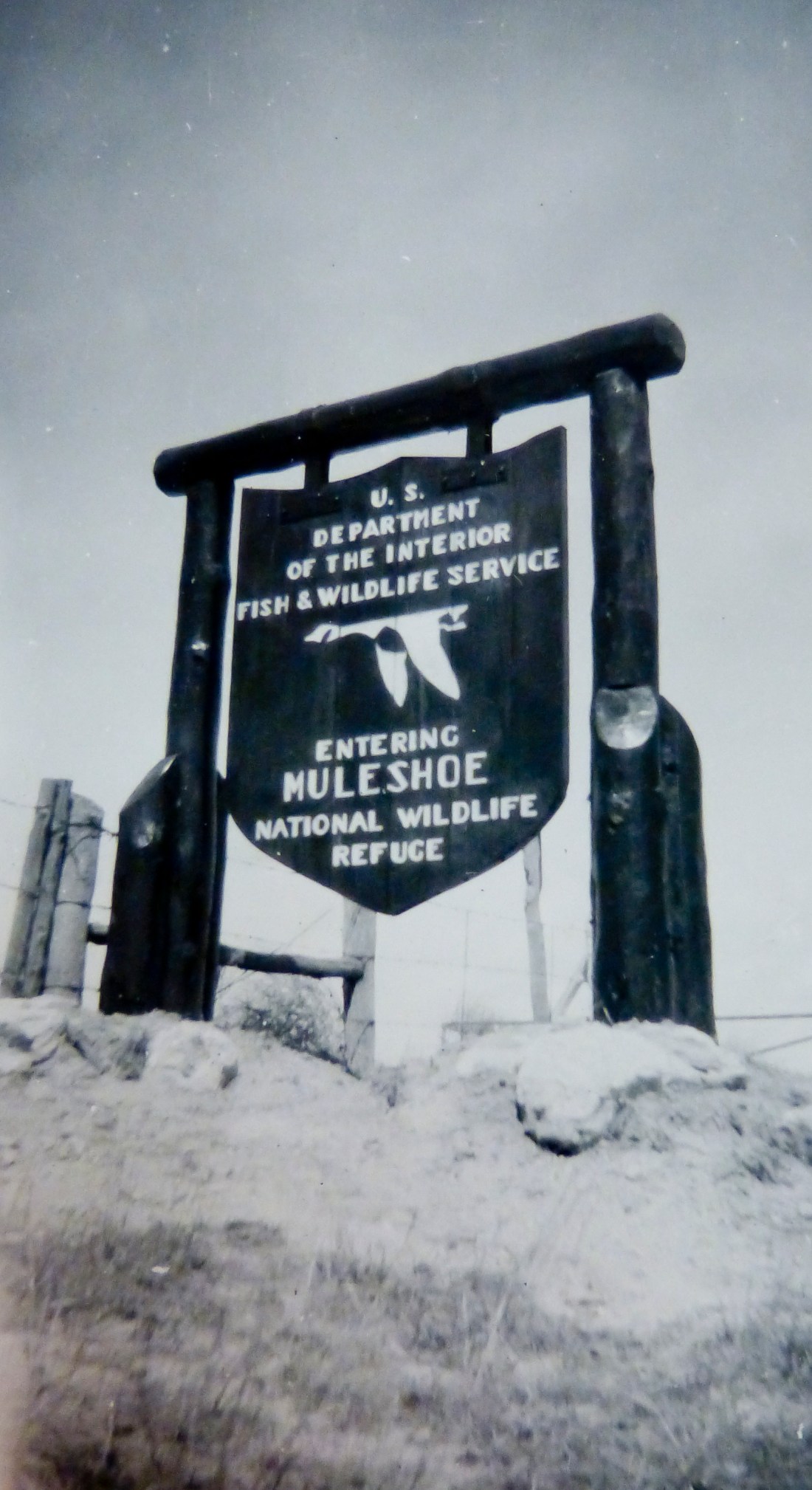
So in 1935, the Federal Government sought safety ports of over five million acres for migratory birds. The Bureau of Biological Survey considered 20 areas in the Texas Panhandle before they decided the lakes south of Muleshoe were the best for the acquisition and development by the agency. The lakes were in the heart of the country reporting the most damage from the feeding activities of migratory birds.
Among the last standing untouched native shortgrass prairie, Texas’ oldest National Wildlife Refuge was established after President Franklin D. Roosevelt signed Executive Order No. 7214 on Oct. 24, 1935. At that time it was the smallest refuge purchased by the agency of around 5,800 acres.
By creating the Muleshoe National Wildlife Refuge it became a win-win situation for regional farmers and for migratory birds.
With the signing of the Executive Order, the acquisition of the refuge lands began. The first purchase was in 1936 where the refuge headquarters is located from George, Mattie, and Annie Robinson.
The second land purchase, comprised of land located east of Texas 214, including Paul’s Lake, in December 1936, from Frank, Mattie, and John Paul.
The third land tract was purchased in February 1937, from Henry and Vivian Wilson and was of the southeast part of the refuge, including White Lake. The fourth acquisition of the southwest area of the refuge occurred in 1938. It was acquired from Isaac and Crawford Enochs.
Refuge lands were first placed under the protection of a caretaker in May 1937. The refuge’s first manager, James Walton, took charge in August 1937.
The original plan of development and management for the Muleshoe National Wildlife Refuge included provisions for water developments, including a system of dikes, dams, and diversions to assure that there would be a permanent water source on the refuge even in times of extreme drought. Along with water development, the refuge planted trees and shrubs in the upland areas and would manage for upland game birds.
Not only did the refuge provide protection for birds, but also in its first years gave much-needed jobs for unemployed men. With the establishment of the Works Progress Administration Project in 1938, the headquarters buildings, residence, diversion canals, and dikes were built. The WPA workers planted approximately 80,000 tree and shrub seedlings on refuge lands during the spring of 1938.
There were up to 112 WPA workers at the refuge until 1942. By May 1942, all the buildings and major improvements on dikes and roads were completed — about the time the WPA program was terminated.
In 1940, the Bureau of Biological Survey became the U.S. Fish and Wildlife Service. By that time authorities estimated that refuge lakes were home to 250,000 ducks.
Muleshoe NWR is part of the High Plains Natural Area, and was designated as a National Natural Landmark of the Great Plains Natural Region on Aug. 11, 1980. The designation promotes good land stewardship for the protection and restoration of natural resources.
The refuge has changed little since the early days of the Llano Estacado and maintains one of the last shortgrass prairie environments on the Southern High Plains.
Wildlife in the refuge is still abundant, with lesser sandhill cranes still migrating to it yearly. Perhaps, visitors might glimpse a pair of Golden eagles playing in the strong updrafts of the high rocky outcrop at the Muleshoe Refuge and effortlessly soaring, diving and feinting at each other.
It’s why the refuge was created — for protection of bird species.
